16–26 August 2007
Seeking a secluded spot away from the heat of the Maryland summer, Tom fled for the cold Canadian Rockies and managed to convince Johanna it would be a good idea (with the assistance of polypropylene). This page reveals their journey.
|
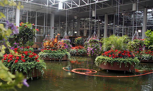
After flying into Calgary, we visited the Devonian Gardens, a park on top of a 3-story shopping mall. (See Wikipedia for more about the garden.) |
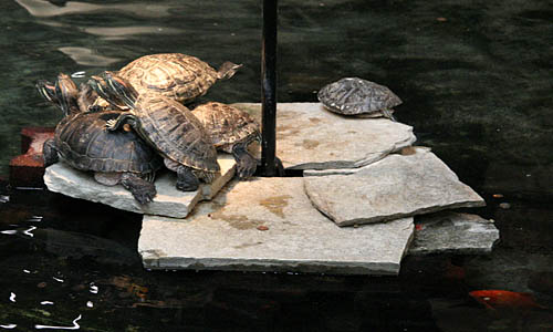 |
These turtles piled under a heatlamp in the Devonian Gardens were the first charismatic fauna we encountered in Canada. |
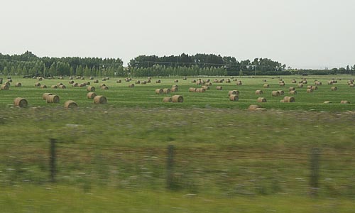 |
Just after leaving the Calgary city limits one encounters the western plains while heading for the mountains. |
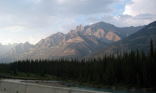 |
Soon one encounters the Bow River and the exciting terrain that is its progeny. |
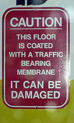 |
We encountered the sign to the left in the Calgary Westin
subterranean parking garage. There was no indication about how one might
damage the membrane, or what would happen should that occur.
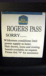
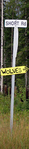
The sign to the right was in our first night’s hotel which was immediately adjacent to the Transcanada highway, but in a very remote location. The power lines failed on the second morning, so there was no water for about an hour, but the hotel has a generator to keep the lights on. |
 |
The next morning we set off for Nakimu Cave. While the meeting site for the hike was the parking lot of our hotel, the meeting time was 6:30am.
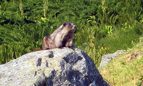 |
This charming fellow is a hoary marmot. ("Hoary" means "gray-haired", and should be used more often.) They whistled loudly to announce the presence of humans. |
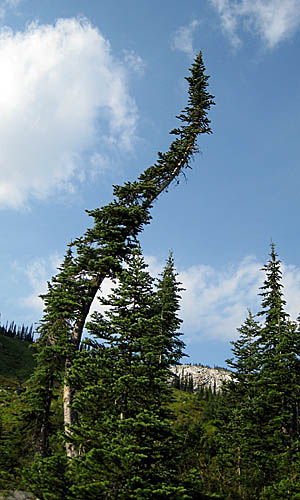 |
Up here, the mountains are so steep and the snow is so deep that many of the taller trees are curved. The snow pushes down in the winter and the tree attempts to grow straight in the summer. One of our guides worked in the Avalanche Control division, where they launch howitzers to trigger avalanches. |
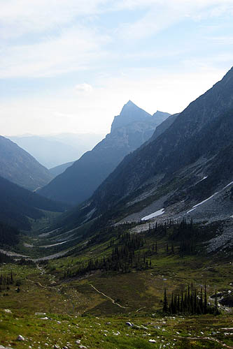 |
This photo looks down Cougar Valley from the summit; the trail we hiked to the summit meanders down from the lower right corner of the photo. |
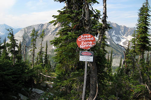 |
The trail to Nakimu Cave is closed at the end of the Cougar Valley because grizzly bears have taken residence on the far side. |
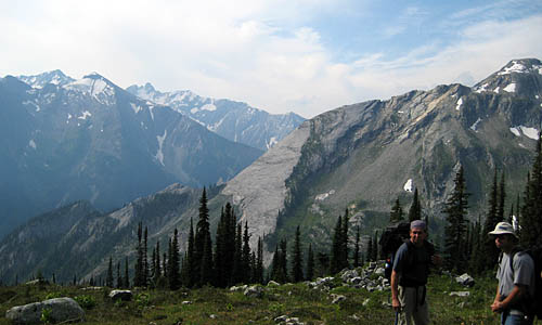 |
And what a great view those grizzlies have in the back valley! From the top of the Cougar Valley, we hiked down the far side, about as far down as the bottom edge of the giant angled rock slab in the center of the photo. |
 |
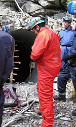 |
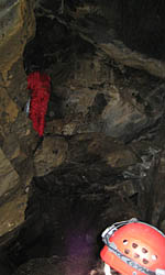
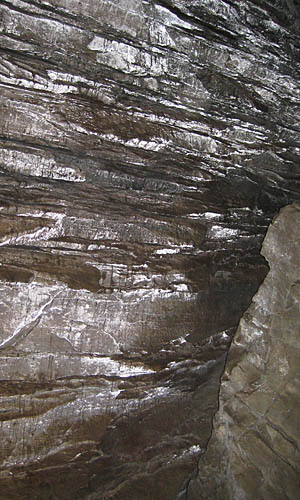
Nakimu is the Shuswap word for “grumbling spirits”. If the spirits neglected to bring hard hats and kneepads, they'd be doing a lot more than grumbling as they banged their heads and patellae into the rocks. We very stylishly concealed our kneepads beneath our pants. The entrance is shown to the left; immediately after entering we descended a chain-link ladder shown to the right. We spent almost 4 hours underground, exploring up and down, with occasional spaces big enough to stand up in and others involving lengthy slithering including one path known as Fat Man's Misery. The lower left photo shows the glistening condensation covering some surfaces. In the glow of headlamps, they looked metallic silver. We exited by climbing up an underground waterfall into the bright daylight. |
 |
 |
|||
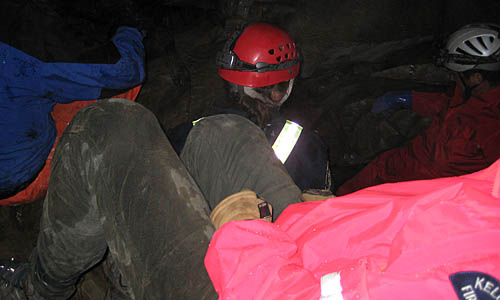 |
One of the less spacious areas of the cave. Folks who knew what they were doing brought special-purpose caving suits. We grunged our regular clothes. The glacier-fed river still flows through the cave and its mighty roar gives navigational cues though the sinewy maze. |
 |
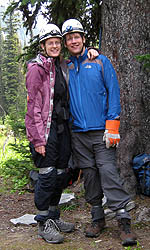
This may look like an Elf exploring Middle Earth, but it's actually Johanna. This photo was taken by Cat, one of the others on the hike. Everyone else on the hike lived within an hour’s drive; we were the “American Couple”. |
 |
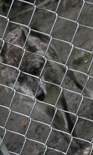 |
We visited the Northern Lights Wolf Centre, where they educate folks about wolves and have some on site. |
 |
 |
Waking up to this sight each morning in Banff was quite pleasant. |
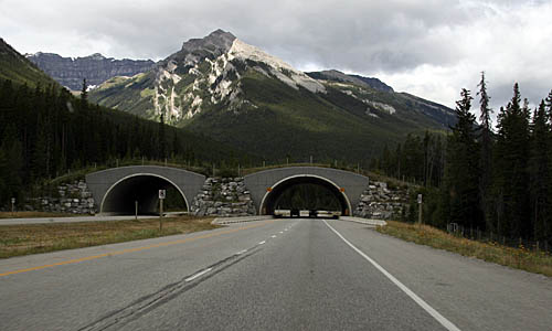 |
This wildlife bridge over the Transcanada Highway allows animals to cross the road. |
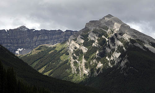 |
This closeup of the mountain in the above photo shows the wacky lumpy geography. You really don't want to get between two tectonic plates when they collide. |
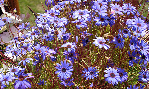 |
The growing season is very short up north, so all the plants emerge simultaneously in the brief summer to play. |
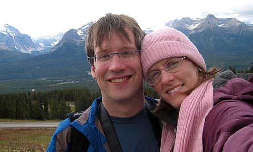 |
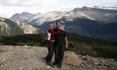
Portrait of us, with mountains.
|
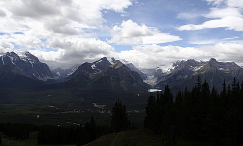 |
That's Lake Louise to the right of
center; this photo atop the gondola lift.
|
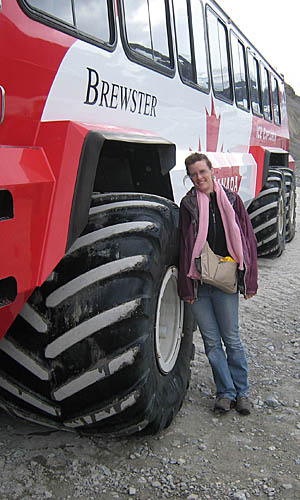 |
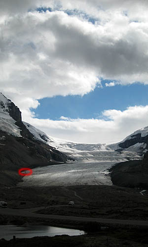
This gigantic Snocoach drives on the 18-degree slopes they carve through the moraine to take tourists out onto the surface of the glacier. The speck in the red circle to the right is a Snocoach. |
 |
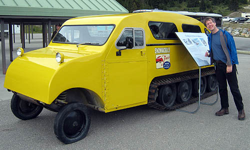 |
In the olden days, they used these delightful half-track Bombardier snowmobiles. This one has a bit of a flat. |
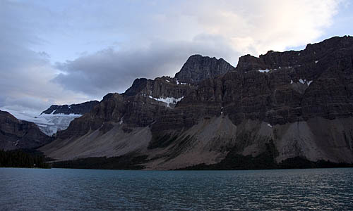 |
Some random lake with an overhanging glacier. |
 |
The view from our first night’s campsite at Laughing Falls. |
 |
It seems a shame to put all these great mountains out here so far from everything else. Perhaps the Canadians would be willing to lend one of the smaller Rockies to put on display in Greenbelt National Park. |
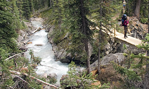 |
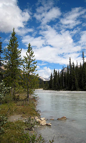
To cross swift glacial rivers, Parcs Canada has built handy bridges. |
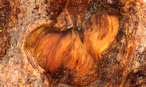 |
Even the bark is exciting. |
 |
 |
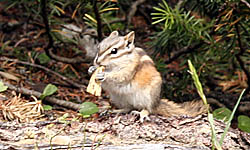 |
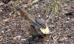
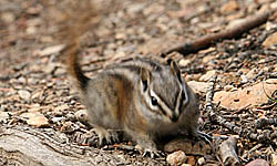
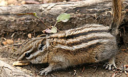
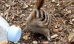
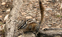
Chipmunks moved so quickly to grab crumbs that they sometimes show up as just a blur on camera, even with a shutter speed of 1/125 second. |
 |
 |
 |
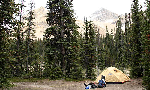 |
Little Yoho Campground was our second night for camping, and had a much nicer bathroom. |
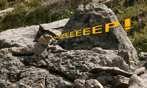 |
This mighty pika followed us along the trail, loudly announcing us to his kin. For a better sense of how cute these little critters are, listen to David Attenborough. |
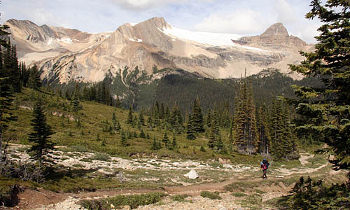 |
Directly above Johanna in this photo is Whaleback Mountain, which we had partially climbed the previous day. |
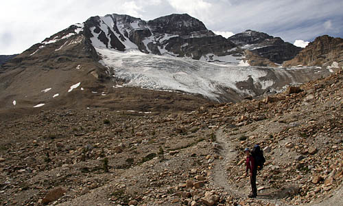 |
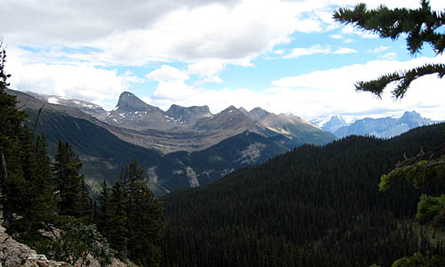
Above the treeline only glaciers interrupt the barren landscape. |
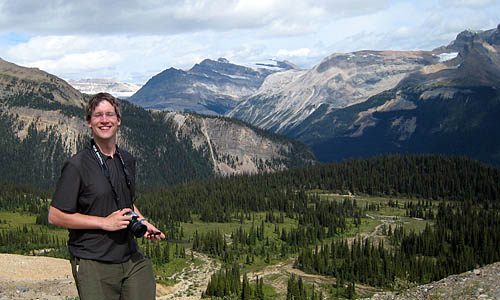 |
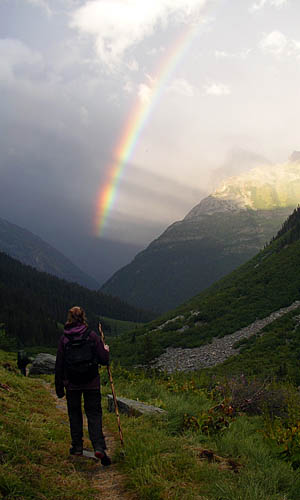
The satisfying thing about hiking in alpine mountains is that you can often see exactly where you've been (or where you're going). Right behind me the trail snakes off far into the distance. |
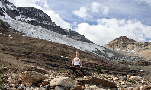 |
Johanna shows calm defiance practicing yoga with back turned to this enormous glacier moving toward her. |
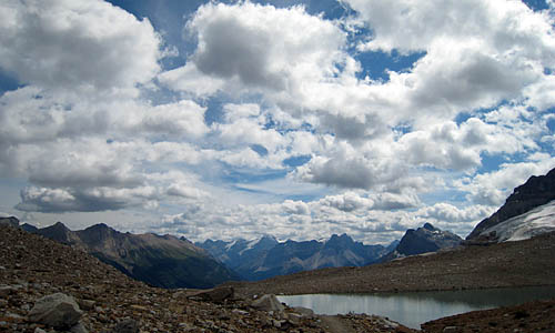 |
The top of the world. |
 |
Write your own caption. |
 |
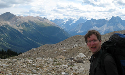
The Australian who took this photo advised us to avoid engaging his conservative associate in conversation. |
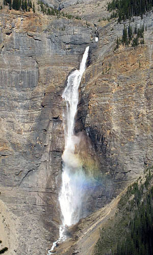 |
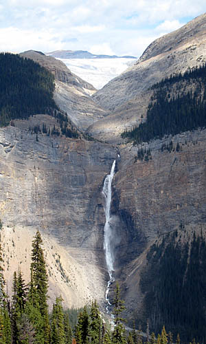
Takakkaw Falls is one of the highest waterfalls in Canada, as long as you don't quibble that the water keeps banging into rocks on the way down. Its rumble can be heard for miles. To the right you can see the bigger picture, including the Daly Glacier from which the meltwater flows down to supply Takakkaw. If you’re looking for falls to go over in a barrel, this would make a particularly poor selection. |
 |
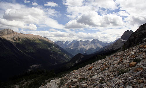 |
Just another typical alpine landscape. |
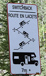 |
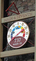
The sign to the left shows how vehicles longer than 7 metres have to back up the middle segment of the mountain switchbacks on the road to Takakkaw Falls. Google Maps lists this as "Unknown Road". To the right is a giant outdoor thermometer in Canmore. Note that it ranges from 35°C (95°F) down to -35°C (-31°F). |
 |